In the impression of many people
Gansu is a remote western province
There is a large area of dry land, full of wind and sand
And the desolate and chilling frontier
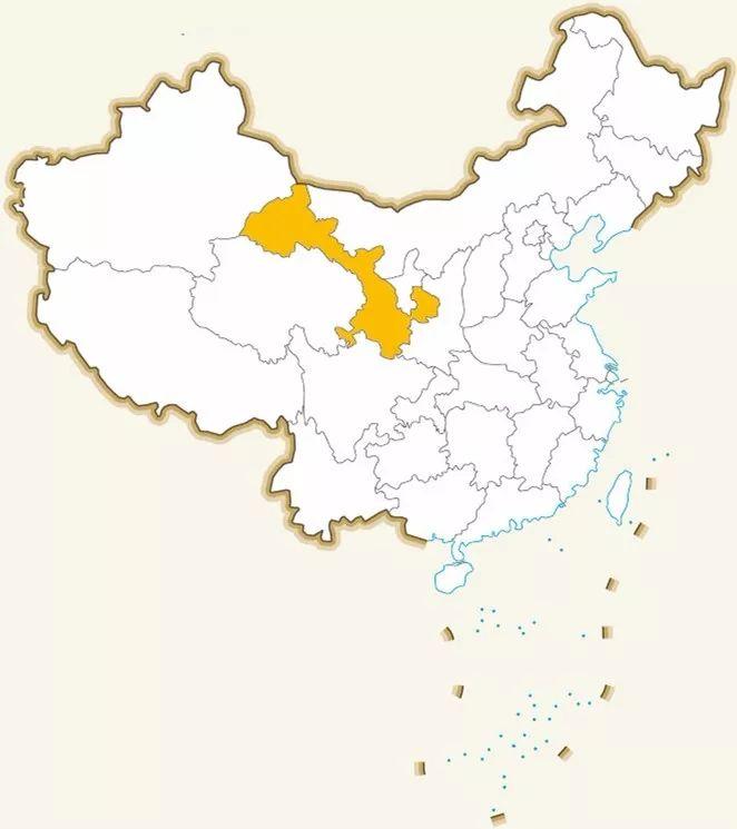
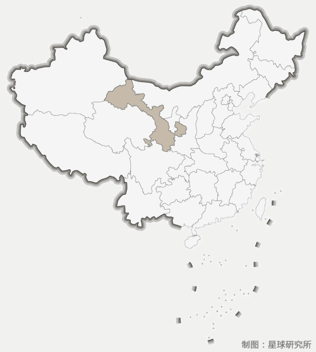
From the administrative division map of China
It seems to be trying to extend to the west
Gradually away from the hinterland of the East
(Map from @State Forestry Administration)
▼
Other than that
You must still have an impression
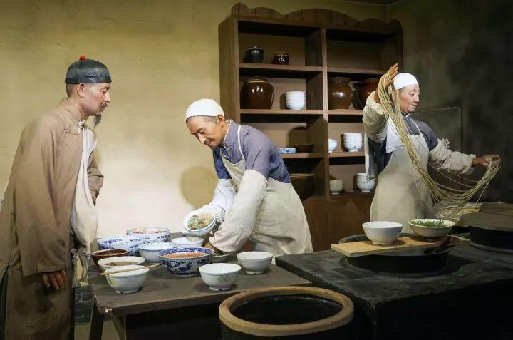
That is, all the travel guides about Gansu will be introduced in full color
How to eat a bowl of authentic Lanzhou beef noodles
Since 1915, the Hui people Ma Baozi made the first bowl of noodles
Lanzhou beef noodles are only a hundred years old
Articles recommending beef noodles have already been plentiful
In contrast
There are very few articles that can deeply and comprehensively interpret Gansu
Because it's very difficult to tease out the context and think deeply from the vast amount of information
But inertial thinking
And it's easy to make guides that list information without thinking
Gansu in the eyes of the public
A remote and desolate ramen province
That's how it was formed
(Mabaozi ramen scene reappears, photographer @Wangdu88/123RF)
▼
Gansu is the most diverse and all-encompassing province in China
A variety of very different natural scenery
Animals and plants that do not melt together are gathered here
Various histories, cultures, nationalities, religions
It's also where they all meet, conflict, merge
And the more diverse the more beautiful
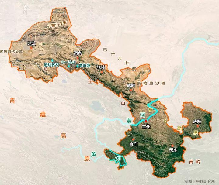
It all starts with the formation of Gansu
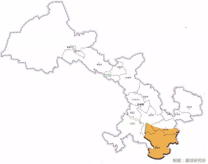
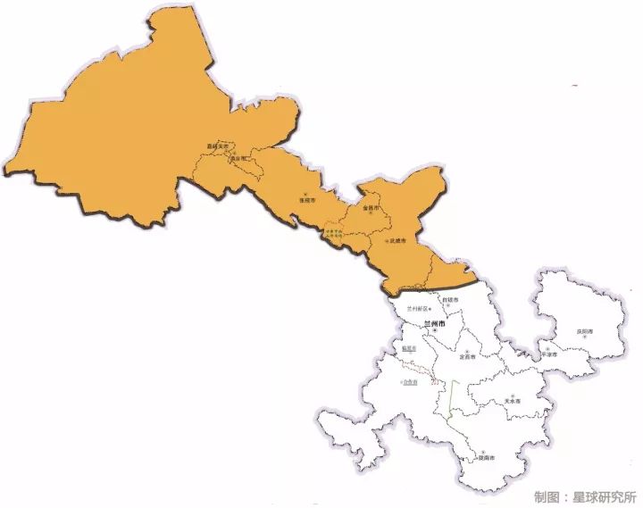
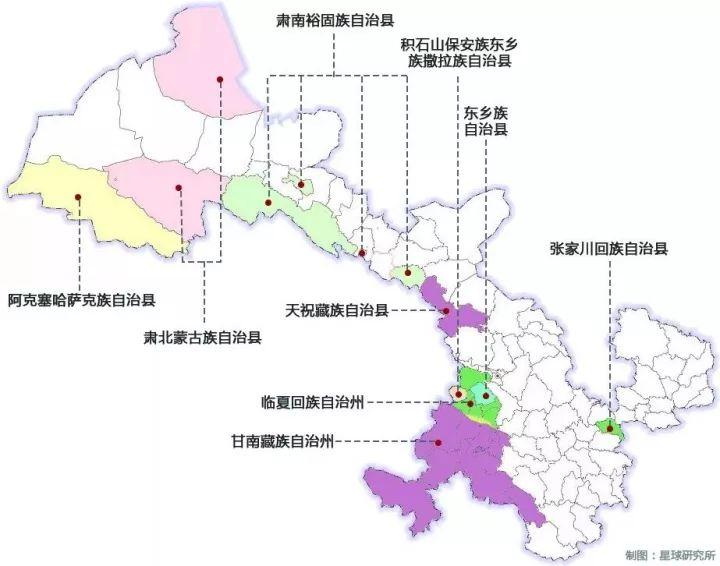
By geographic division
Gansu can be divided into four regions
The formation of each region
Both originate from epics woven together by geography and history
Ⅰ
Around 1960 BC
The ancestors of the Zhou people did not (bu zhu) due to the chaos of the Xia Dynasty
"Losing his official and running between the army and the emperor"
He led the Zhou tribe to avoid the chaotic Central Plains
Came to Qingyang, Gansu Province, which was regarded as the land of military and di at that time, to cultivate and reproduce
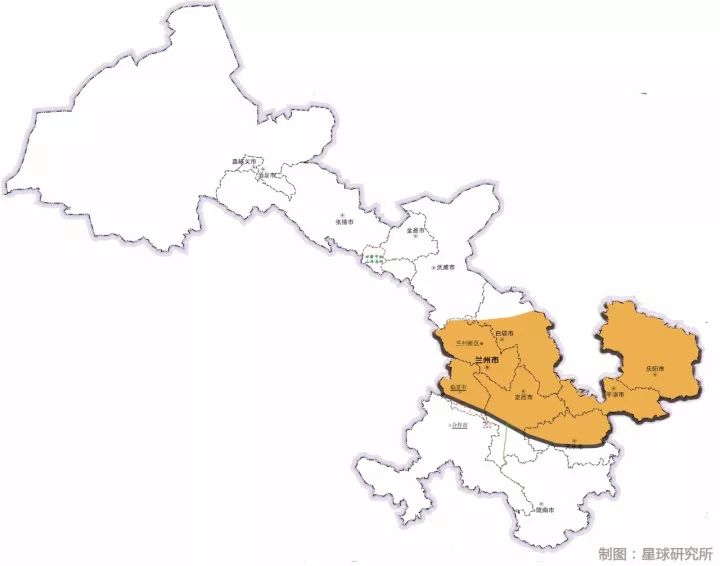
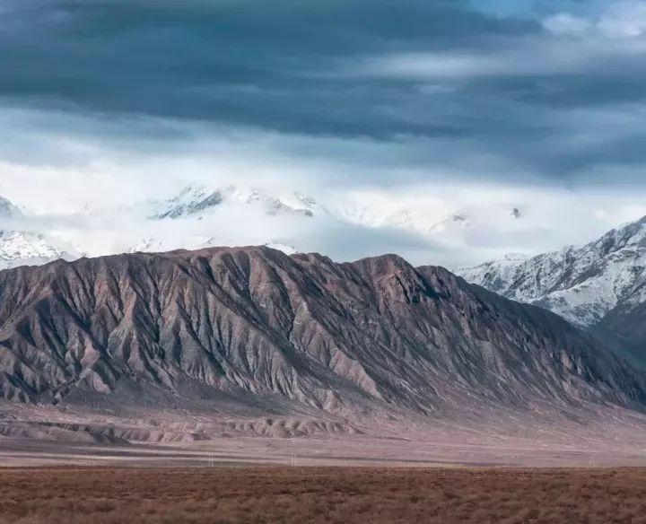
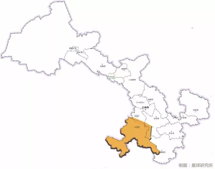
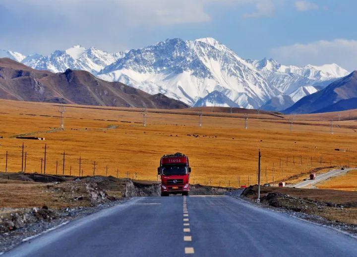
1st Geographical Region of Gansu
Longdong, Longzhong Loess Plateau
Here we go
(Cartography @Wind Melancholy/Planet Research Institute, click to zoom in. The bottom picture comes from @Gansu Bureau of Surveying, Mapping and Geographic Information)
▼
This Loess Plateau contains
Today's Lanzhou, Dingxi, Qingyang and many other places
The ravines are vertical and fragmented
(Lanzhou Gaolan County Aerial Photography, Photographer @Freezing Eye)
▼
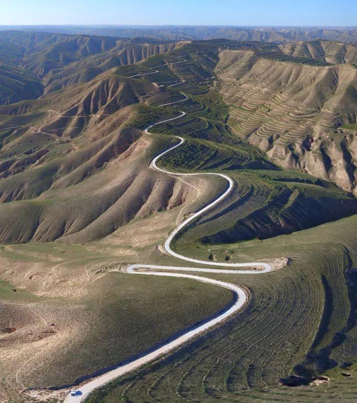
The road can only meander on the ridge
(Dingxi Lujiagou Landform and Highway, photographer @Wang Hongbin)
▼
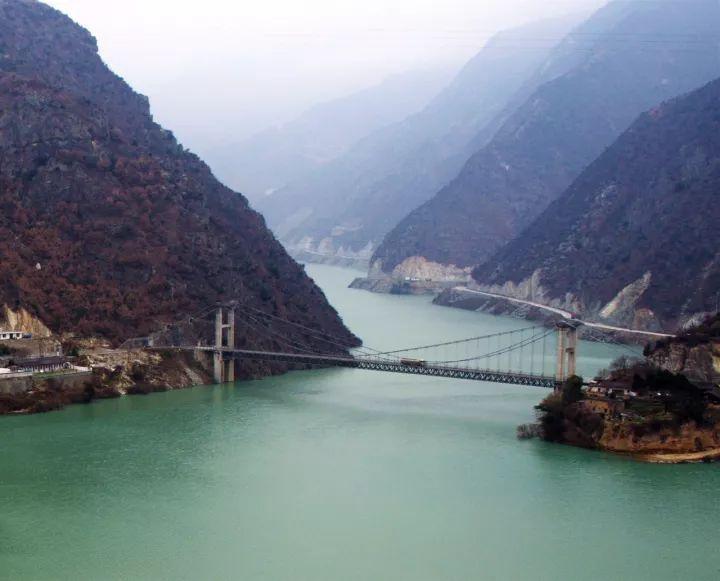
The Yellow River also passes through here
Wander east
(Please watch the mobile phone horizontally, Liu Jiaxia of the Yellow River, photographer @Qiu Menghan)
▼
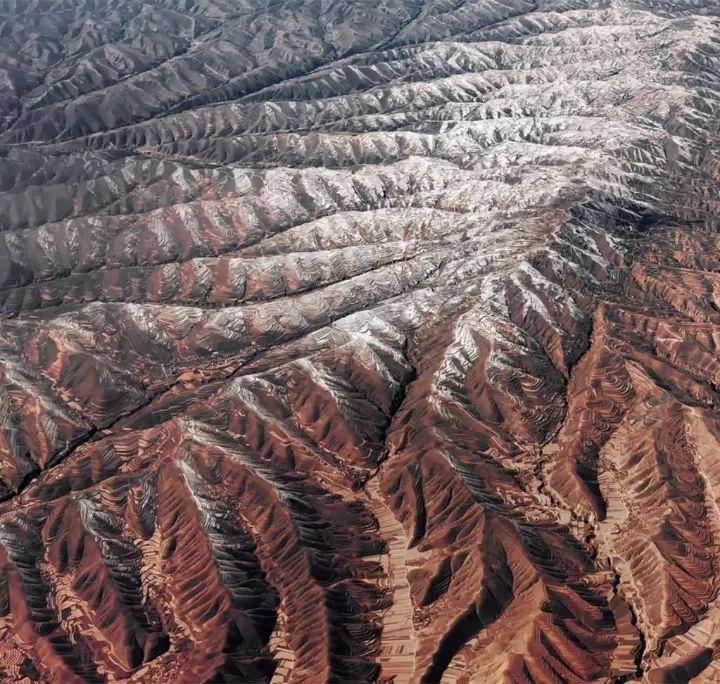
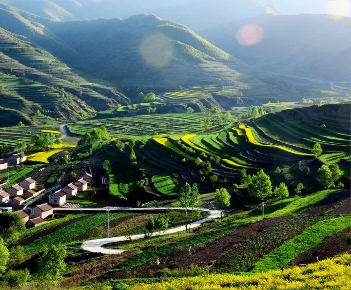
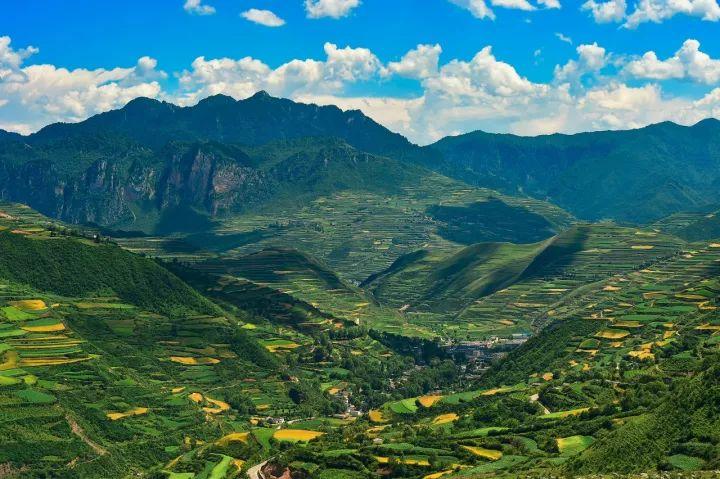
Although there are thousands of ravines on the surface
The top is a big or small flat
Plus easy-to-cultivate loess with an average thickness of 50-80 meters
This place has long been a fertile field for "Wo Ye Miwang"
View from the air
Winding and stacking
(Please view your mobile phone horizontally. Qinglan Township, Dingxi Anding District, photographer @Wang Hongbin)
▼
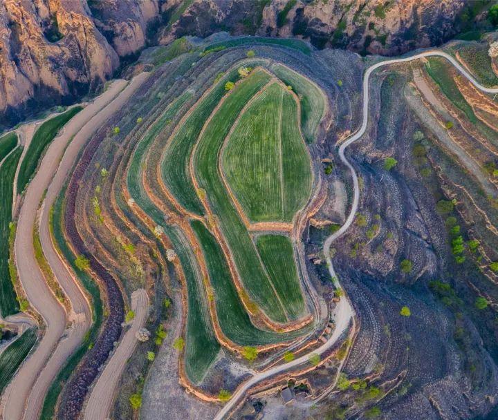
Even an ordinary hill
Can also be well organized
(Xifeng, Qingyang, Gansu, photographer @Chen Ming)
▼
Spring
Thousands of trees twisting branches, hundreds of flowers blooming
Red, yellow, green, white
It's so colorful
(Xiyang Township, Kongtong District, Pingliang City, photographer @Wang Yaqin)
▼

Summer
Longshan Mountain with an altitude of more than 800 to 2,000 meters
Blocked the water vapor from the east
Let it get relatively more precipitation here
The Loess Plateau is actually without "loess"
Completely covered in thick greenery
(Counterfeit products township, Huating County, Pingliang City, photographer @Wang Yaqin)
▼
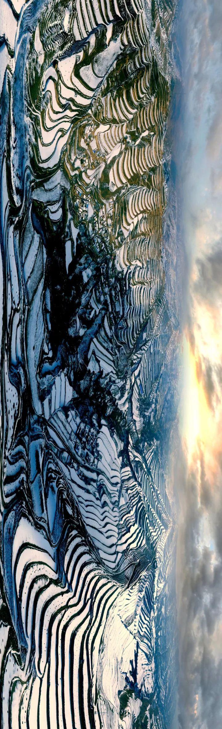
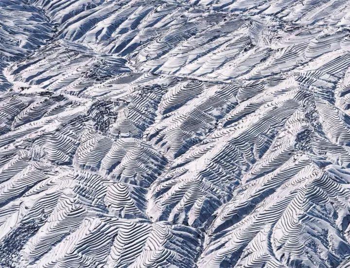
Winter
Earth make-up, snow-capped
The loess terraces gather round and round to the top of the mountain
Like the fingerprints of the earth
(Gaolan County, Lanzhou, photographer @Freezing Eye)
▼
The Zhou tribe who migrated here
Brought advanced agricultural production technology
null
The Zhou tribe also gradually developed and grew
The first is to expand from Qingyang to Qishan, Shaanxi
After that, the prelude to Wu Wang's logging of Zhou was opened from the Weihe River Basin
The final full-fledged Zhou tribe
Established China's last hereditary slavery dynasty
Zhou Dynasty
Ⅱ
It has been staged many times in Chinese history
Dynasty change at the center of fringe conquest
However, Gansu has more than one opportunity
Around 890 BC
Yingfeizi, the leader of the Ying tribe
Outstanding ability to raise horses
Assigned to "Qin" by King Xiao of Zhou
Specialized in raising horses for the royal family in "Qin"
The "Qin" at that time was not Shaanxi
It is located in today's Qingshui County, Tianshui City, Gansu Province
So far
2nd Geographical Region of Gansu
Longnan Mountains
Here we go
(Cartography @Wind Melancholy/Planet Research Institute, click to zoom in. The bottom picture comes from @Gansu Bureau of Surveying, Mapping and Geographic Information)
▼
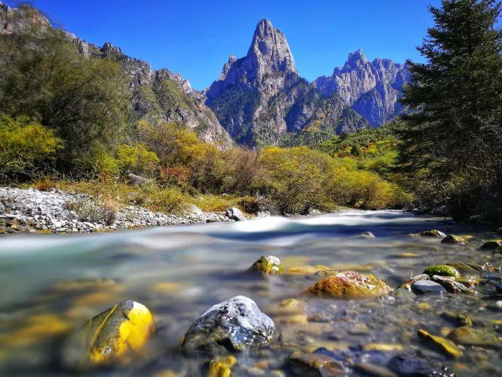
It roughly includes the south of Weishui
Mountains east of Lintan and Diebu line
Covering parts of Longnan City, Tianshui City and Gannan City
Here the Qinling Mountains come from the east
The Minshan Mountains come from the south
The mountains meet, the mountains are stacked, the mountains are high and the valleys are deep
Today, in this small area, there are
3 national and 1 provincial nature reserves
3 National Forest Parks and 2 National Wetland Parks
(Guanyenggou Waterfall, photographer @He Yixuan)
▼
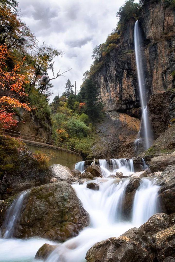
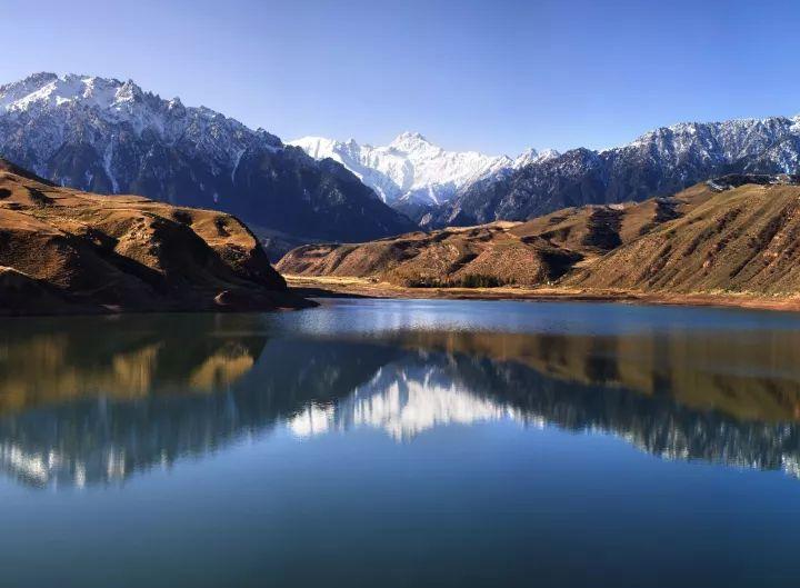
For example, Guangogou Tianchi
A pool of clear waves is like a mirror, two mountains face each other into a painting
Like a wonderland on earth
(Reflection of Guangogou Tianchi, photographer @Hu Weidong)
▼

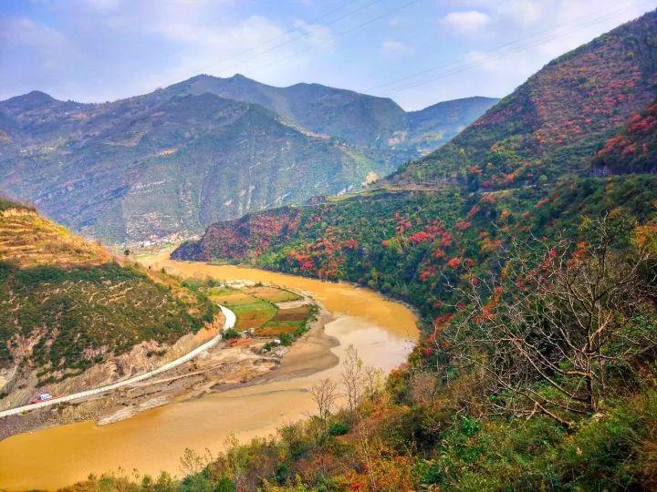
Longnan mountainous area has abundant rainfall and rich vegetation
Many rivers developed
Beautiful Bailongjiang
Flowing 450 kilometers in Gansu
It is the mother river of Longnan
(Photographer @Chen Haitao)
▼
Another important river
Western Han water
Once separated a Qin couple from the two sides
Acacia turned into a famous sentence through the ages
"Jianjia is pale, white dew is frost
The so-called Yiren, on the water side "
(Photographer @direction)
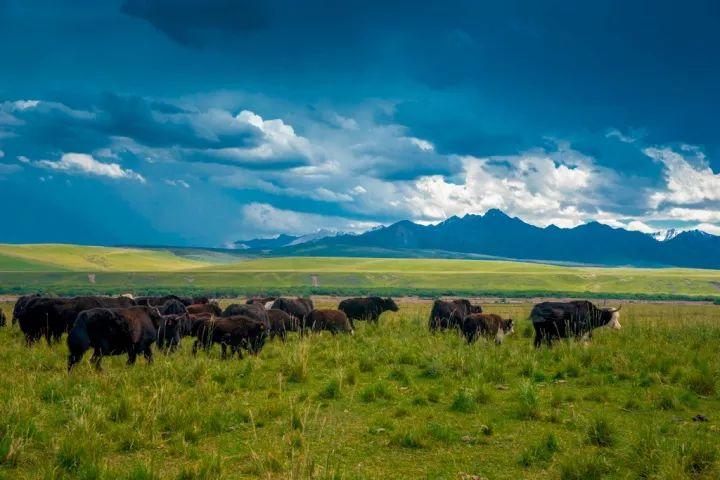
▼
When the river rushes out of the mountains
On both sides of the valley and in the gentle places of the mountains
Nourish lush grass
Qin people can raise good horses here
A good horse can equip a strong army
In addition, the Qin people have been fighting against Xirong for a long time
Gradually form an armed force stronger than the Central Plains
On the other hand
Longnan mountains are also rich in salt
As the most important economic resource at the time
Salt can provide great wealth for Qin
It is relying on the nurturing of Longnan Mountains
The Qin people for more than 600 years
Gradually expand the territory
Until the Liuhe is wiped out
Established China's first centralized dynasty
Qin
(Expansion map of the Qin people, mapping @Fengyu/Institute of Planet Research, the bottom map comes from @State Forestry Administration)
▼
Ⅲ
Qin established the prototype of the Chinese Empire
And the Han who inherited the territory of the Qin Dynasty
But has been facing the harassment of the powerful neighbors in the northwest, the Huns
After generations of emperors keeping a low profile
The increasingly powerful Han Empire began to attack and destroy the Huns
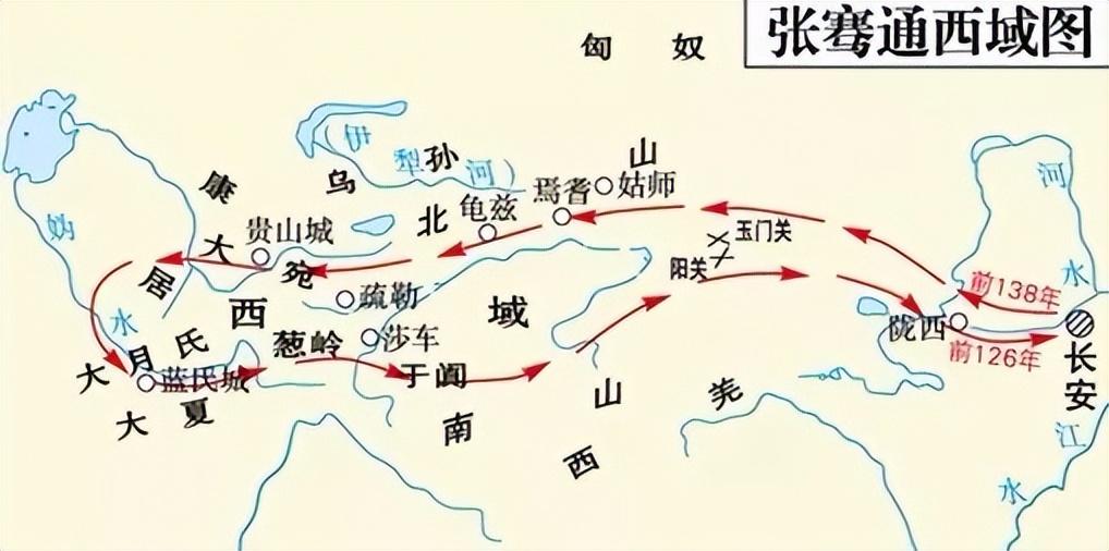
At this time, Emperor Wu of the Han Dynasty learned from the captives
The Huns have a sworn enemy in the Western Regions
Otsuki (da zhī)
He decided to recruit warriors to the Western Regions to unite Dayueji
"Break the right arm of the Xiongnu"
(From the perspective of sitting north and facing south, the Western Regions are located to the right of the Huns)
139 BC
Zhang Qian was called to
Historically known as "Clearing the Western Regions"
▼
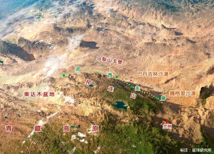
So the third geographic area of Gansu
Hexi Corridor
Here we go
(Cartography @Wind Melancholy/Planet Research Institute, click to zoom in. The bottom picture comes from @Gansu Bureau of Surveying, Mapping and Geographic Information)
▼
It is located west of the Yellow River
The two deserts of Badain Jaran and Tengger
Waiting for an opportunity to go south on its north side
The Qinghai-Tibet Plateau with thin air and the arid Qaidam Basin
Then don't give an inch on the south side
In addition, the Qilian Mountains, Heli Mountains, Longshou Mountains and other north-south confrontations
Form this narrow corridor with a width ranging from several kilometers to nearly 100 kilometers
From the Central Plains to the Western Regions in the Han Dynasty
Except for this narrow corridor
Almost no way
(3D topographic map around the Hexi Corridor, mapping @Anton Balazh/123RF, planetary institute added annotations)
▼
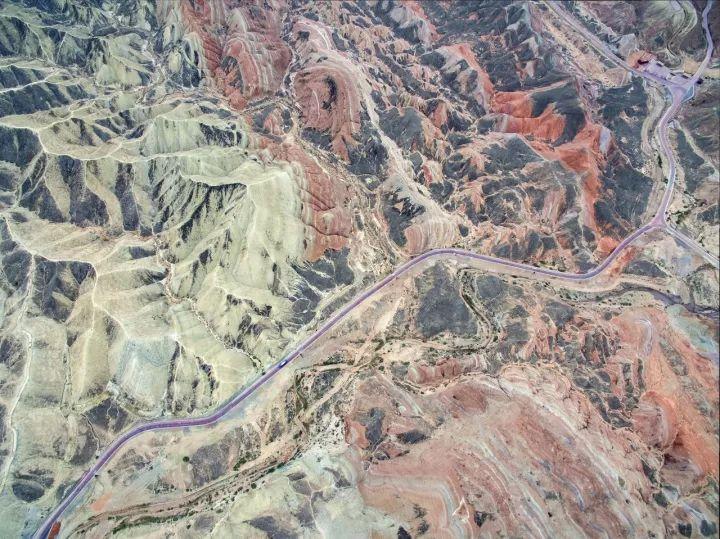
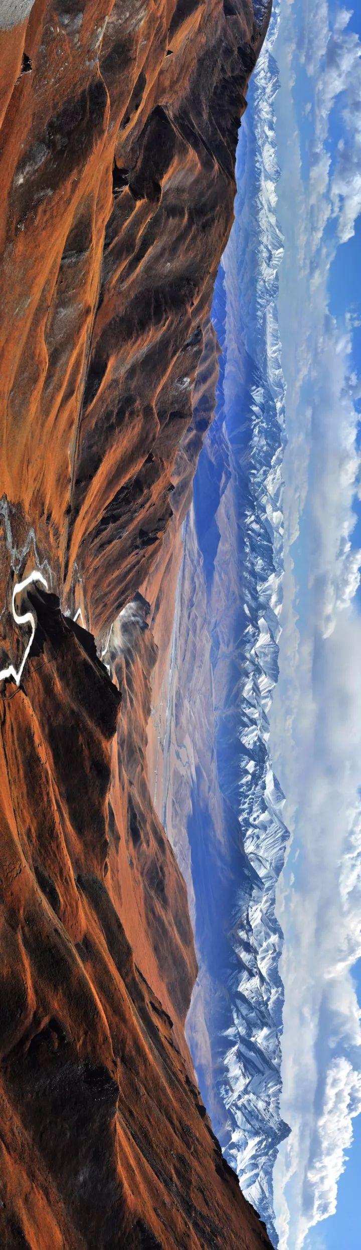
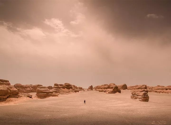
The Hexi Corridor has little rainfall and is very dry
View from the air
The earth is thirsty and cracked like a flame
(Zhang Ye Danxia aerial photography, photographer @Jiao Xiaoxiang)
▼
Fortunately
On the south side of the corridor is the tall Qilian Mountains
(Qilian Mountains, taken on the plane from Dunhuang to Lanzhou, photographer @Jiang Hong)
▼
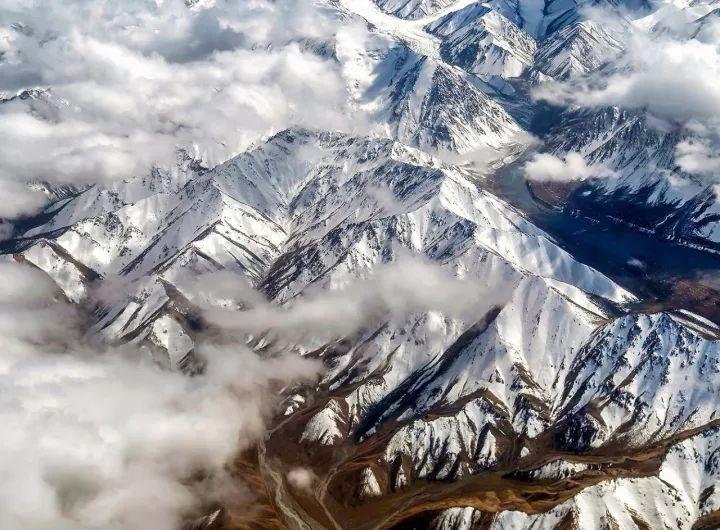
Snow-capped mountains floating in the clouds
In stark contrast to the arid corridor
(Jingtie Mountain in Qilian Mountains, photographer @Qiu Jianjun)
▼
The Qilian Mountains are 800 kilometers long
The average altitude is over 4000 meters
(Please view your mobile phone horizontally, Sunan Section of Qilian Mountains, photographer @Li Chun)
▼
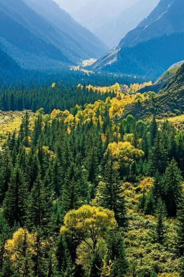
Tall mountains intercept water vapor-rich clouds
Rainfall is abundant in the eastern part of the Qilian Mountains
Lush forests grow on the mountains
(Yangshugou, Sunan County, photographer @Li Chun)
▼
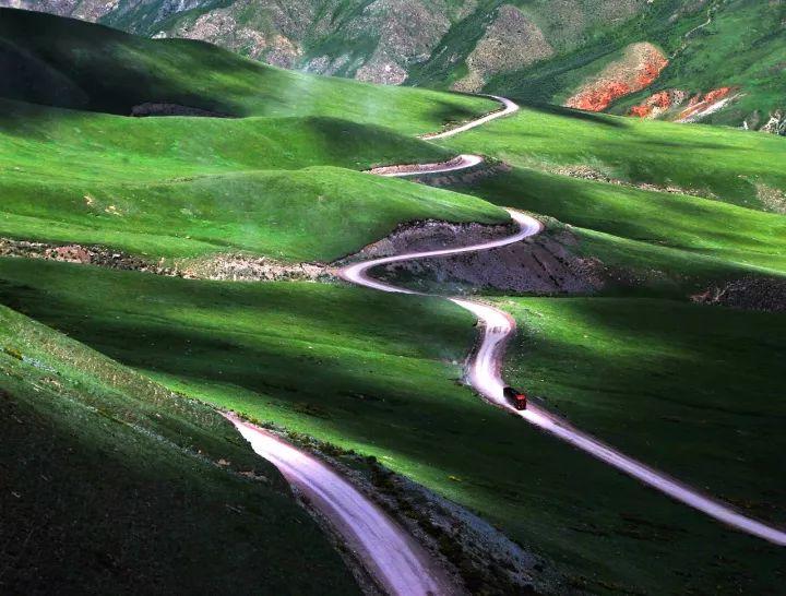
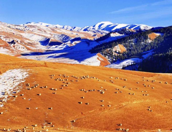
The northern foothills of the Qilian Mountains
It also has a total area of up to 24,000 square kilometers
Qilian Mountain Grassland
(Roads and Grasslands in Sunan County, Zhangye, photographer @Li Chun)
▼
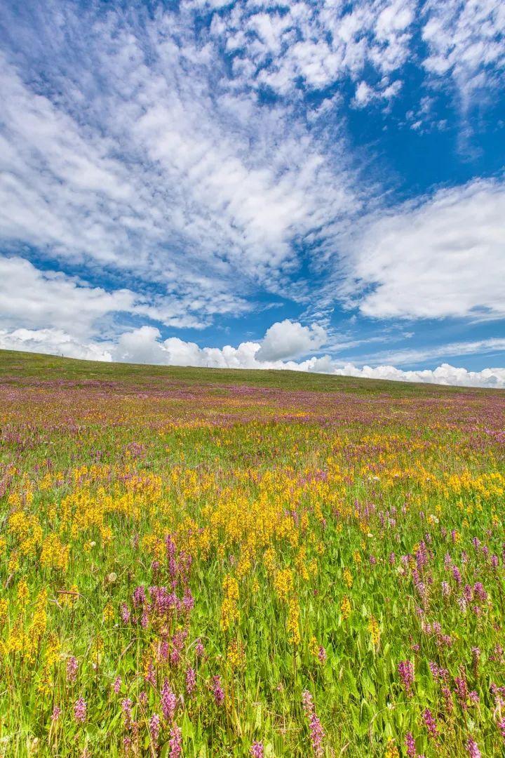
The meadows are vast
(Kangle Grassland, photographer @Zeng Jianjun)
▼
Wildflowers everywhere
(Kangle Grassland, photographer @Yuan Bo)
▼
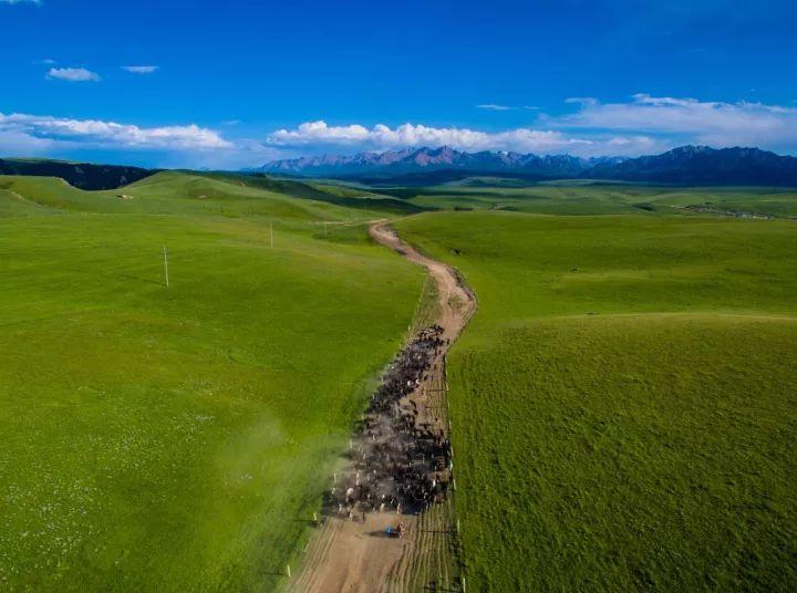
The world's largest military horse farm
Sandan Military Horse Farm
Right here
It has been a huge military base since the Western Han Dynasty
(Shandan Military Horse Farm, photographer @Liu Zhongwen)
▼
For this treasure
There have been countless wars here in history
null
null
null
null
null
null
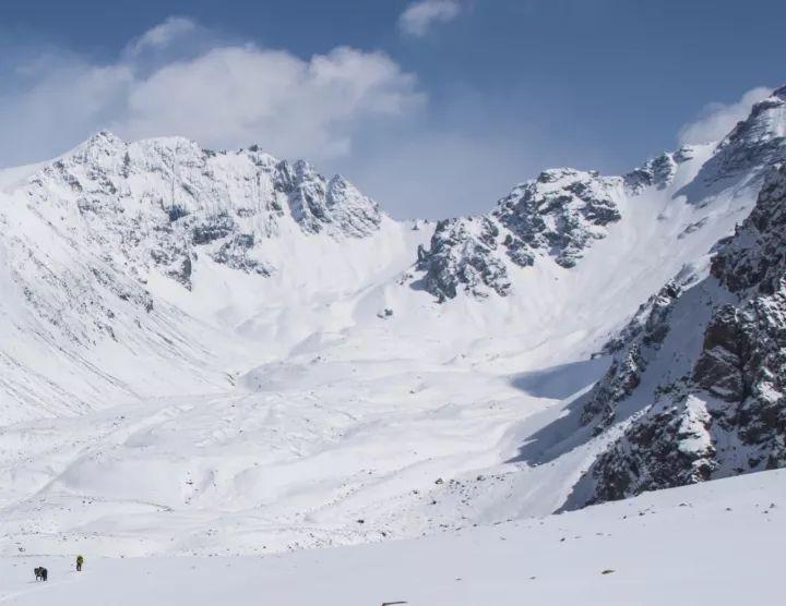
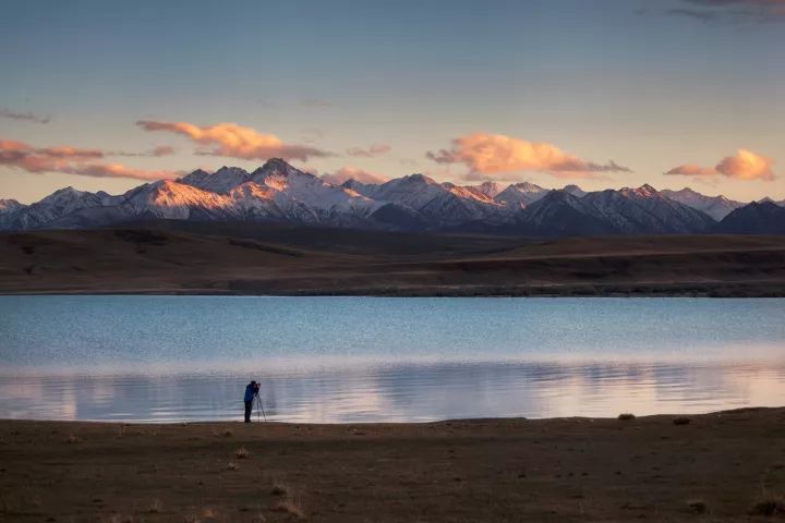
More than 3,000 glaciers have also developed
Water storage is about 132 billion cubic meters
Equivalent to 100 Miyun Reservoirs in Beijing
(Suzhulian Glacier in Nanshan Corridor, photographer @Li Chun)
▼
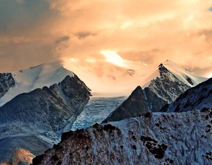
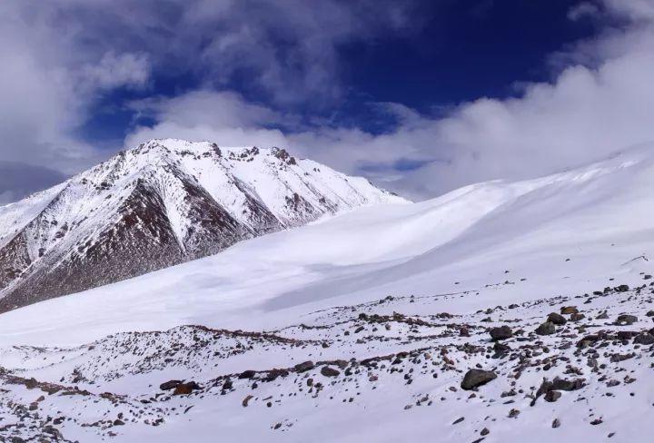
The snow peak is majestic and dangerous
The snow accumulation area is wide and vast
(Crossing the Qilian Mountains from Zhangye Dadu Ma, pay attention to the person at the bottom left, photographer @Li Chun)
▼
The snowfields are endless
All you can see is a pure and white world
(July 1st Glacier, photographer @Li Zhaoqing)
▼
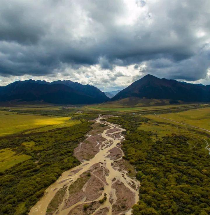
Glacier meltwater plus mountain rainfall
Converge into a river among the valleys
Formed multiple water systems that flow to the Hexi Corridor
(Lenglongling Xidahe, photographer @Liu Zhongwen)
▼
Or a trickle
(Qilian Mountains, photographer @Lin Beian)
▼
Or flood
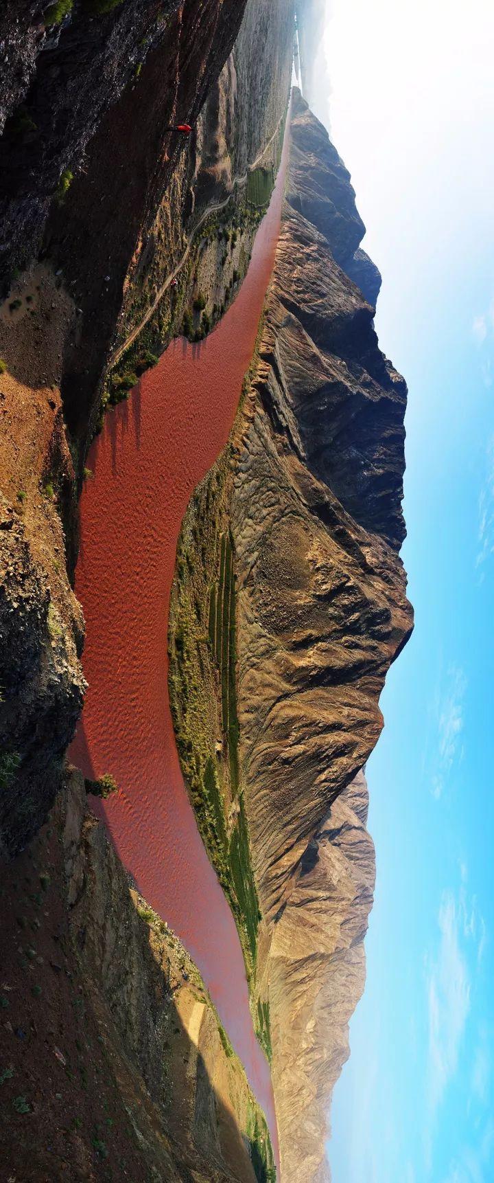
(Please view Justice Canyon, a red river formed by floods and sunlight, photographer @Li Chun)
▼
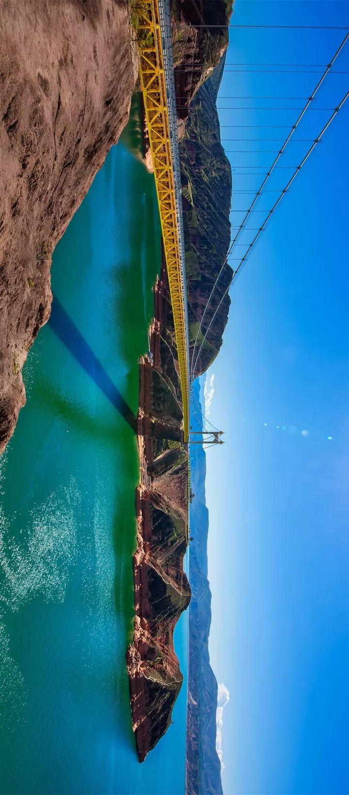
Among them, Heihe, the largest river in the Hexi Corridor
It is the second largest inland river in China after the Tarim River
It is exactly what the ancients called "three thousand weak waters".
It was born from the Qilian Mountains
All the way through oases, Gobi, salt marshes, deserts
Until the Juyanhai Sea in Ejina, Inner Mongolia
So it is also called the Ejina River
(Heihe Evening Photo, photographer @Li Chun)
▼
The Dang River is the only river that irrigates the Dunhuang Plain
Without it, there would be no Dunhuang culture
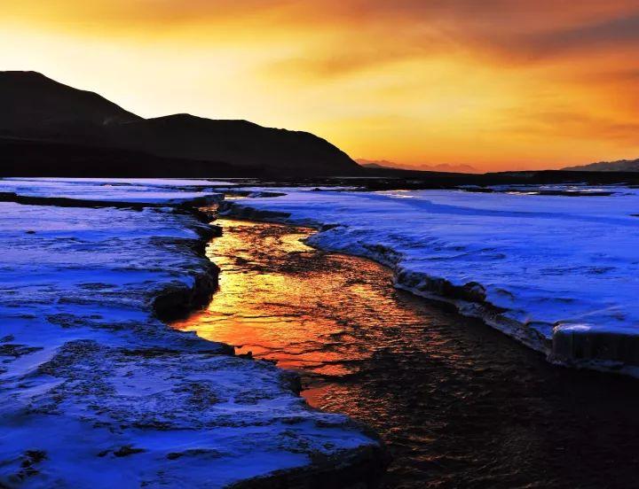
(Danghe, Frozen Water in Winter, Photographer @Jiang Hong)
▼
Wuwa Pond in Dunhuang
Just on the edge of the desert Gobi
Create a water town
(The mountain in the distance is Al Jinshan, photographer @Jianghong)
▼
Wafangcheng Reservoir
Snow-capped mountains reflected in lake water
Change into a charming and beautiful scenery
(Zhangye Wafangcheng Reservoir, photographer @Li Chun)
▼
West Dahe Reservoir
Even more extreme
It can overlook the northern foot of Lenglongling in the Qilian Mountains
null
null
▼
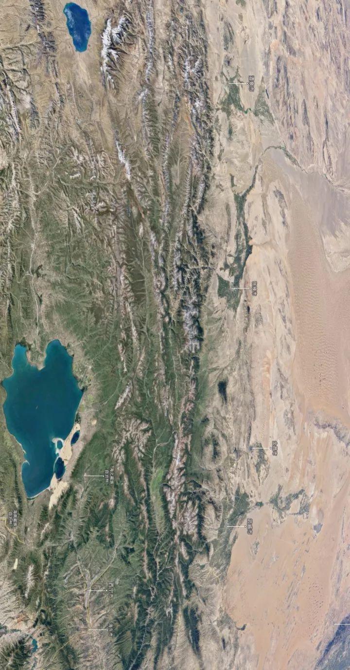
These water systems flow to the Hexi Corridor
A series of oases nourish the arid land
As you can see from this Google satellite image below
Wuwei, Jinchang, Zhangye, Jiuquan at the northern foot of Qilian Mountains
It is built on an oasis
(Please view your phone horizontally, the map comes from @Google)
▼
The existence of a series of oases
Let Zhang Qian and his followers enter the Western Regions along the oasis
Emperor Wu of the Han Dynasty was also in these oases
Four Hexi counties were set up
Jiuquan County, Wuwei County, Zhangye County, Dunhuang County
Oasis also provides the survival basis of farming civilization for these counties
Under the long-term attack of nomads on the north and south sides
The four counties in Hexi have long been firmly controlled by the Central Plains Dynasty
Very closely related to this
Opened up the Hexi Corridor
The Central Plains Dynasty no longer curls up in a corner
Begin to communicate closely with the wider outside world
This exchange reached its peak in the Tang Dynasty
It has also driven the economic development of the Hexi Corridor
Liangzhou (Wuwei) at that time became the largest city in Hexi
The grain reserves in the entire Hexi region even account for 1/3 of the country's
Fujia National
(The ancient city of Yongtai in the Hexi area is a relic of the Ming Dynasty, photographer @Dreamland)
▼
An open country
Created a splendid civilization
The Hexi Corridor at this time
Not the border, but the road
Not the wasteland but the ambitions of the empire
Ⅳ
Hundreds of years have passed
The time has come on the eve of the establishment of the Yuan Dynasty
Ogutai's second son, Kouduan, came to Tubo from three sides
1247 AD
Kouduan invites Tibetan living Buddha Sakya Pandita to come to Liangzhou
After the talks, the two sides agreed that Tubo would be annexed to Mongolia
In exchange
Kuoduan converts to Tibetan Buddhism
Since then, Tibetan Buddhism has been able to walk out of the Qinghai-Tibet Plateau
Began to expand to the Mongolian plateau and even the whole country
This alliance is called
"Liangzhou Association"
At this time
The 4th Geographical Region of Gansu
Gannan Plateau
Here we go
(Cartography @Wind Melancholy/Planet Research Institute, click to zoom in. The bottom picture comes from @Gansu Bureau of Surveying, Mapping and Geographic Information)
▼
The Gannan Plateau belongs to the edge of the Qinghai-Tibet Plateau
During the Han and Tang Dynasties, only part of the counties became the counties of the Central Plains Dynasty
It was not until the Yuan Dynasty that it was brought under the jurisdiction of the central government as a whole
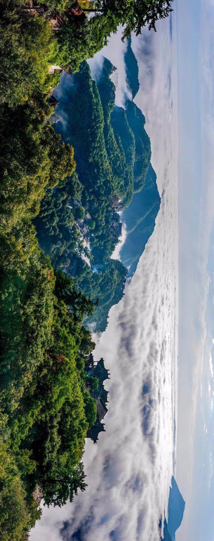
(Yeliguan, Lintan County, Gannan, photographer @Qiu Menghan)
▼
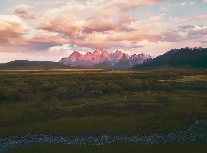
Minshan, Xiqing Mountain, Jishi Mountain
Three mountains run through the entire Gannan Plateau
Makes there are many mountains here, and the mountain shape is unique
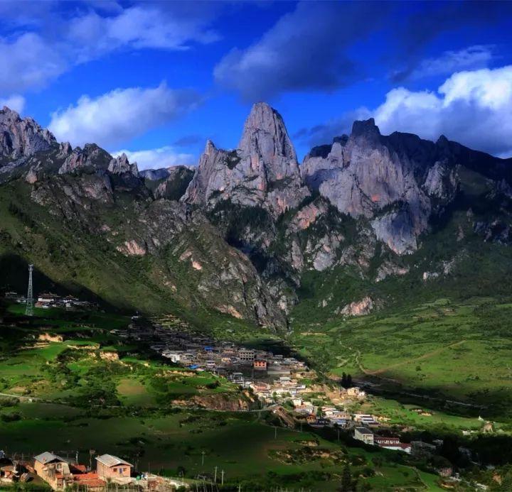
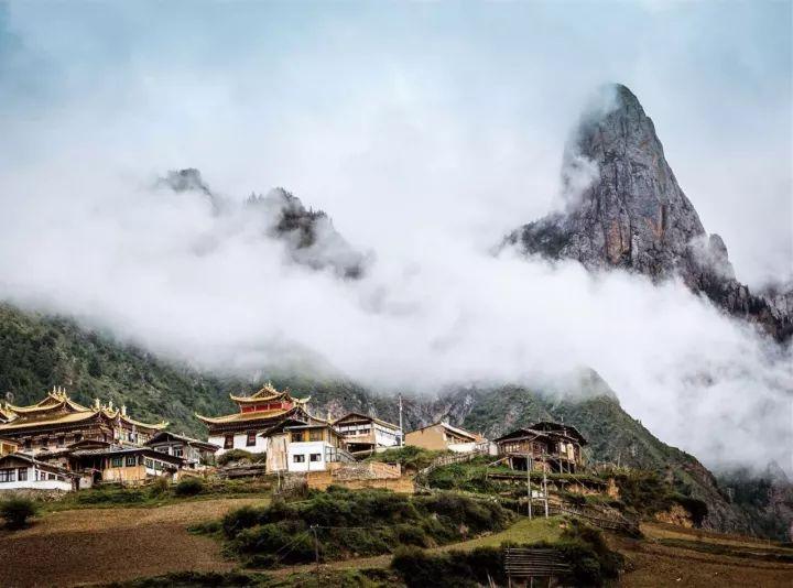
Gannan's Zhouqu, Diebu
The mountains are high and the gorge is deep, the climate is warm and the forests are dense
(The mountain near Zagana, Diebu, photographer @Li Chun)
▼
There are many little-known villages hidden under the mountain
Such as Zagana
(Photographer @Hu Weidong)
▼
It's always cloudy
Like a paradise
(Photographer @Lu Wei)
▼
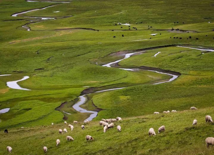
Gannan's mediocrity, Ma qu
On the northeastern edge of the Qinghai-Tibet Plateau
The climate is alpine and the grasslands are vast
Ma Qu means "Yellow River"
River bend on the grassland
Twists and turns, lingering
(Awancang Township, Maqu County, photographer @Zuo Xuelan)
▼
Thereafter
The Yuan Dynasty was established under the names of Ganzhou (Zhangye) and Suzhou (Jiuquan)
Gansu Province
Gannan was officially included in Gansu in the Qing Dynasty
So far
Loess Plateau, Longnan Mountains
Hexi Corridor, Gannan Plateau
The main body of Gansu composed of four major regions is basically formed
Ⅴ
In addition
If we look at Gansu from a broader perspective
Then its uniqueness in China will be clear at a glance
null
null
null
null
It is a "heart of China" that is accessible to all directions.
For example
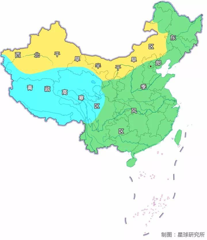
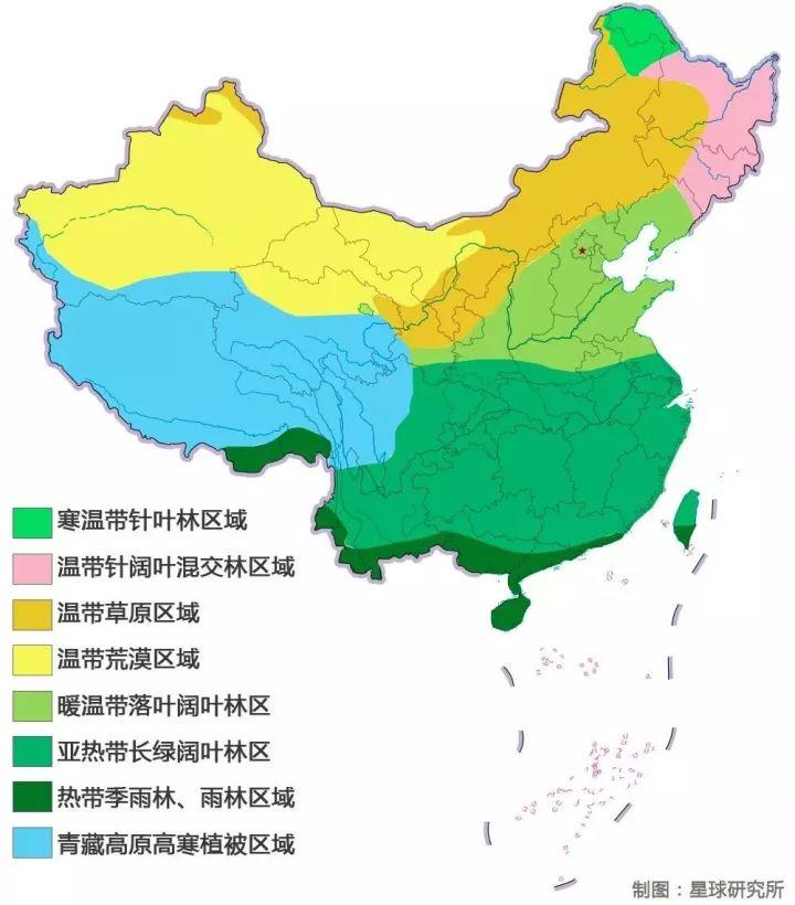
China's Three Natural Regions
Eastern monsoon region, northwest arid region, Qinghai-Tibet alpine region
All meet in Gansu
(Three major natural zoning maps of China, Cartography @Wind Melancholy/Institute of Planet Research, the bottom map comes from @National Bureau of Surveying, Mapping and Geographic Information)
▼
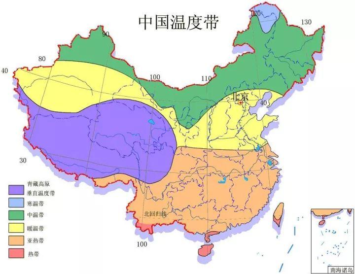
Four temperature bands
Medium temperate zone, warm temperate zone, subtropical zone, vertical temperature zone of Qinghai-Tibet Plateau
Also meet in Gansu
▼
Five major vegetation divisions
Still meet in Gansu
(China Vegetation Zoning, Cartography @Wind Melancholy/Institute of Planet Research, according to China Map Publishing House "China Atlas", the bottom map comes from @State Bureau of Surveying, Mapping and Geographic Information)
▼
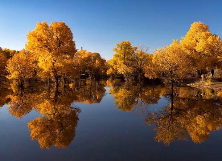
From the golden Populus euphratica
(Jinbo Lake, Kinta County, photographer @Jiang Hong)
▼
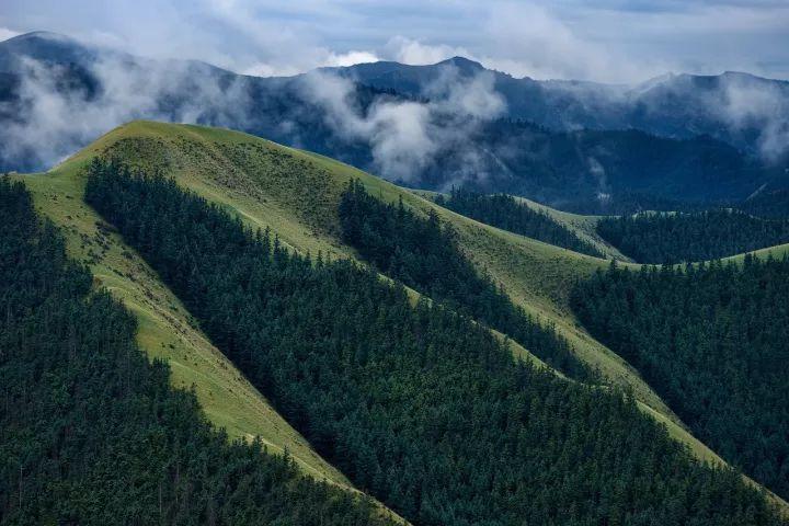
To green fir spruce
(Coniferous Forest in Kangle Grassland, photographer @Qiu Menghan)
▼
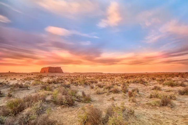
And the low Gobi grass
(Gobi Desert outside Yumenguan, photographer @Yuan Bo)
▼
There are also four major animal divisions
Also meet in Gansu
(China's animal geographic division map, the division method is based on Zhang Rongzu's "China Animal Geography", cartography @Fengshengyu/Institute of Planet Research, the bottom map is from @National Bureau of Surveying, Mapping and Geographic Information)
▼

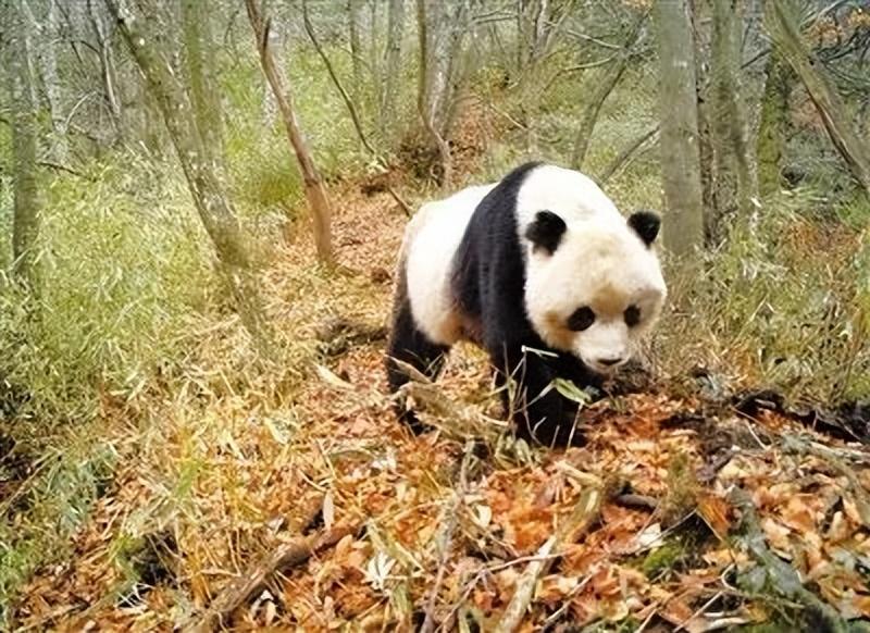
Even the national treasure giant panda
I also found a paradise in the "arid and desolate" Gansu
They are distributed in 7 nature reserves in Gansu
Including Baishuijiang National Nature Reserve
Hejianshan Giant Panda Reserve, etc
(The picture comes from @Gansu Wildlife Protection Administration)
▼
The intersection of various natural divisions
Let the extremely rich landforms coexist in Gansu
(Distribution map of major landforms in Gansu, mapping @Wind Melancholy/Planet Research Institute, click to zoom in, the bottom image comes from @Google)
▼
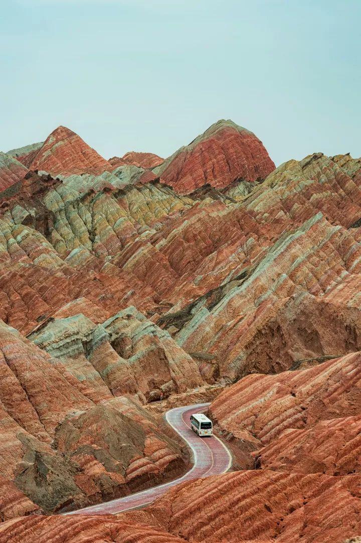
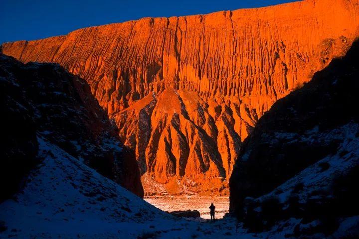
From the monotonous Dunhuang Yadan
(Dunhuang Yadan, photographer @Allen in the distance)
▼
To the gorgeous Zhangye Danxia
(Photographer @Qiu Menghan)
▼
From the mountains
(Sunan Flood Dam, photographer @Li Chun)
▼
To the canyon
(Maying River Grand Canyon, photographer @Zeng Jianjun)
▼
From the grasslands
(Kangle Grassland, photographer @Li Chun)
▼
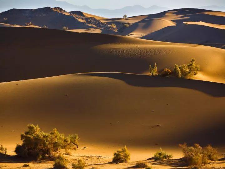
To the desert
(Dunhuang Mingsha Mountains, photographer @Jiang Hong)
▼
Rich geographical environment
The channel connecting the square
It also makes Gansu a national corridor
Different way of life
Multiple ethnic groups with different customs
All coexist on the land of Gansu
(Cartography @Wind Melancholy/Institute of Planet Research, the bottom picture comes from @Gansu Bureau of Surveying, Mapping and Geographic Information)
▼
Buddhism, Tibetan Buddhism, Islam, etc
Many religions shine
Because there is no dominant religion
It also allows all factions to obtain a relatively relaxed environment
There is the first holy place of Taoism here
Kongtong Mountain
(Please view your phone horizontally, photographer @Wang Yaqin)
▼
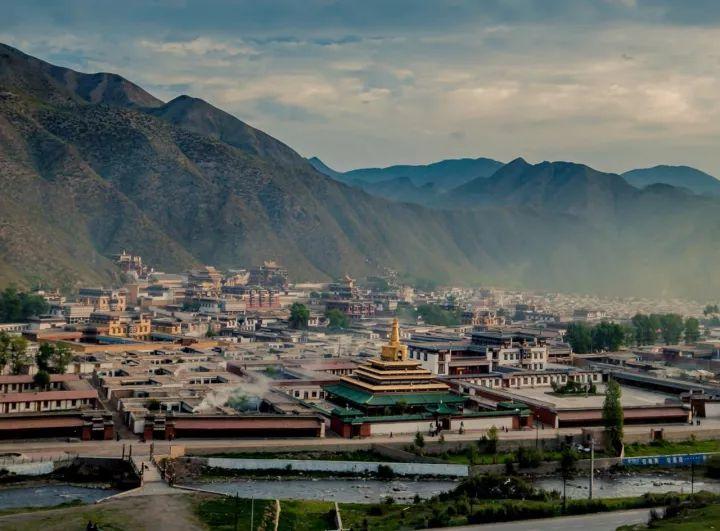
There is also one of the six major monasteries of the Gelug sect of Tibetan Buddhism
Labrang Temple
(Photographer @Mr Shu)
▼
There are also Buddhist grottoes all over Gansu
Such as Mogao Grottoes, Maijishan Grottoes
There are four major grottoes in China, and Gansu occupies only two of them.
A dense mountain actually gathered
221 caves, 10,632 clay statues and stone carvings, more than 1,300 square meters of murals
Maybe it is so many gods and humans together
Created a diverse Gansu
(Maijishan Grottoes, photographer @Mr. Shu)
▼

However
Since the Song Dynasty
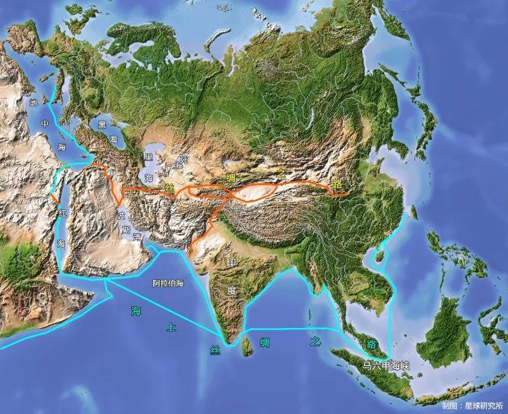
The Central Plains Dynasty lost control of the Hexi Corridor
Navigation technology is also advancing rapidly at this time
The Maritime Silk Road gradually replaced the status of the land Silk Road
(Map of Silk Road Sea and Land Routes, Cartography @Windy Melancholy/Planetary Institute, bottom image sourced from @Michael Schmeling)
▼
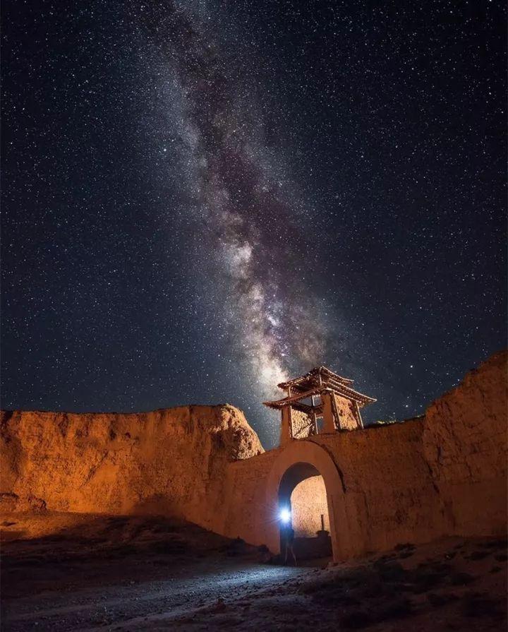
In the Ming Dynasty
The imperial court was in the vast north including Gansu
Build a "deluxe version" of the Great Wall
Its human and financial consumption far exceeds that of the Han and Tang Dynasties
However, the stronger the Great Wall
The more you try to prove the weakness of the country
Gansu is no longer a thoroughfare
But the border of chilling
The Middle Kingdom has also declined
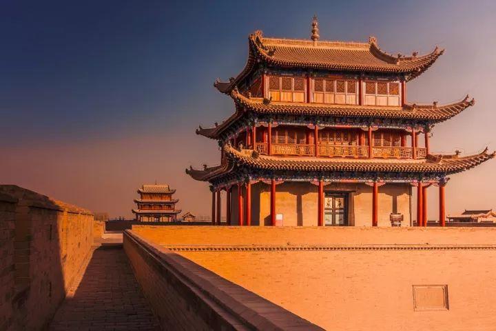
(Jiayuguan Guancheng, photographer @Qiu Jianjun)
▼
Former Gansu
Trapped in backwardness and poverty
Until modern times
Europeans came from the sea
China's maritime civilization reopens
Gansu's per capita GDP has been at the bottom of the country for many consecutive years
Where is the future of Gansu?
In today's opportunity
Because history has proven
The farther west the more beautiful
The more open the more beautiful
The more diverse the more beautiful
Source: National Human History